
Before visiting the Bunya Mountains mid last year we asked around for tips and although a few hands went up, we were short on details. With three roads of varying condition radiating from different points of the compass, how to get to Bunya Mountains was our first question. On this Queensland road trip we were travelling in our caravan so our immediate focus was on Bunya Mountain Campgrounds while for others Airbnb Bunya Mountains might be a good place to start.
Read about another of our Queensland Road Trips in the Sunshine Coast hinterland here.
Bunya Pine trees do still grow on the mountain. Every three years there is a bumper crop of Bunya Cones within which Bunya Nuts are hidden. Do not loiter beneath laden Bunya Trees as those suckers are the size of footballs.
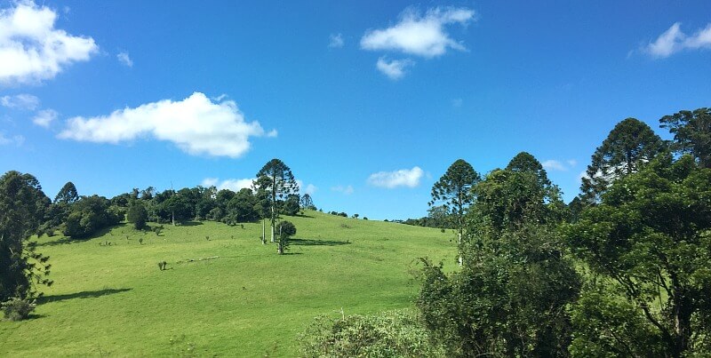
From afar, Bunya Pine Trees can be recognised from their broad shape and slightly dome-shaped top, whereas Hoop Pines are pointed at the top resembling a tall skinny triangle. Bunya Pines also prefer to grow on the range top and Hoop Pines on the lower slopes.
Distinctinve dome-like tops of Bunya Pine Trees
All mountains are intriguing, but Bunya Mountains Queensland doubly so because of their strong Aboriginal heritage and stories.
Surrounded by the quiet of the forest, where even bird calls seemed to echo, it was easy to imagine their presence in days gone by.
Bunya Mountain History
Local indigenous people took the Bunya harvest as an opportunity to invite distant groups to share the bounty. Young nuts were eaten raw and others fire-roasted then pounded into nut meal and formed into cakes.
These monumental get-togethers went on for months, with Bunya nuts providing the main food source. No animals were eaten during this time to conserve fauna reserves. These meet-ups were a chance for the extended community to set laws, share stories and form cultural ties. Sadly the last Bunya Festival took place in the late 1800’s.
Hoop and Bunya pines were felled for timber for 100 years with one saw mill even located at Dandabah, opposite where the National Park’s Office is today. Bunya trees go back to the Dinosaur period but with changes in climate they now prefer cooler mountain tops in Australia. Despite this reduction in habitat, Bunya Mountains have the largest Bunya Forest in the world today.
A 9000 approx. hectare Bunya National Park was established in 1908 and today it has grown to 19,493 hectares. This was quite large for 1908 because even today the popular Noosa National Park in Queensland only covers 4000 hectares.
Nowadays felling timber in a National Park is forbidden, but not so back then. Timber continued to be harvested until 1917.
Walking tracks appeared in 1939 and aided by private rental properties built around Dandabah, a tourism industry grew.
Where are the Bunya Mountains Queensland
The Bunya Mountains are west of Brisbane and north of Toowoomba and are accessible from Gympie, the Sunshine Coast, Brisbane or Toowoomba.
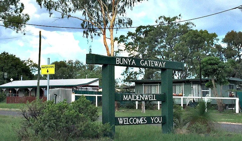
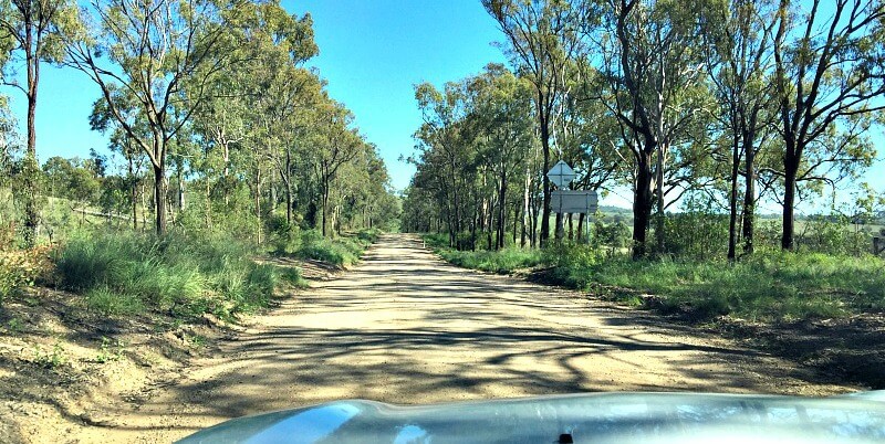
The trip from Brisbane or the Sunshine Coast takes 3 hours. If you’re restricted to bitumen travel go via Toowoomba. If good gravel roads rock your boat then go via Maidenwell. That’s what we chose and we actually free-camped at Maidenwell visiting the Bunyas by day. The road becomes gravel between Maidenwell and the mountains for a few kilometres only and is sealed again before the mountain ascent begins.
We returned home via the northern (Kingaroy) highway, diverting off the highway to explore gravel back roads on our return to Maidenwell. From there we spent a couple of nights in Toowoomba.
Bunya Mountains Weather and What to Pack
Even if you’re visiting in Summer, be sure to pack something warm and dry.
In Winter when temperatures plummet this is doubly important. With an average height of 975 m, mist and lengthy rainy spells occur on the mountain. The closest surrounding towns are approximately 60 km distant so it’s important not to skimp in the wardrobe department.
I suggest packing some cheap light rain ponchos for walks if you don’t have suitable wet weather gear.
Click here for accurate weather information.
Things to do Bunya Mountains Style
The first and foremost thing to do Bunya Mountains is walking in the great outdoors, followed by wildlife viewing and sitting by a fire with a good book and a refreshing brew.
Bunya Mountains Walks
With more than 35 km of walks there are enough to last the most eager bush walker a few days.
We chose the ones below, but use this Bunya Mountains map link to locate them all. This map only shows those walks within the Bunya Mountains National Park. There are an additional four walks in Russell Park (see below).
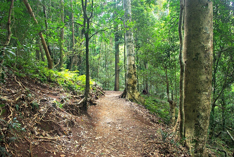
The Scenic Circuit Walk
The Scenic Circuit Walk is 4 km and takes 1 hour.
It was under repair during our visit which just meant that we had to retrace our steps from Pine Gorge Lookout. It still took the same amount of time. Check the Parks website for any closures beforehand, otherwise they will be noted at the trail head.
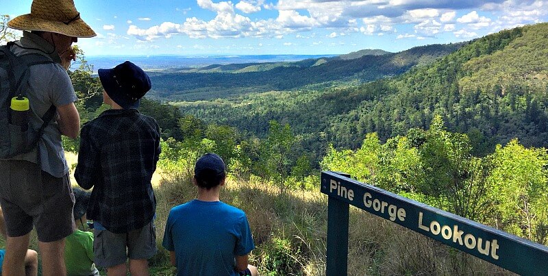
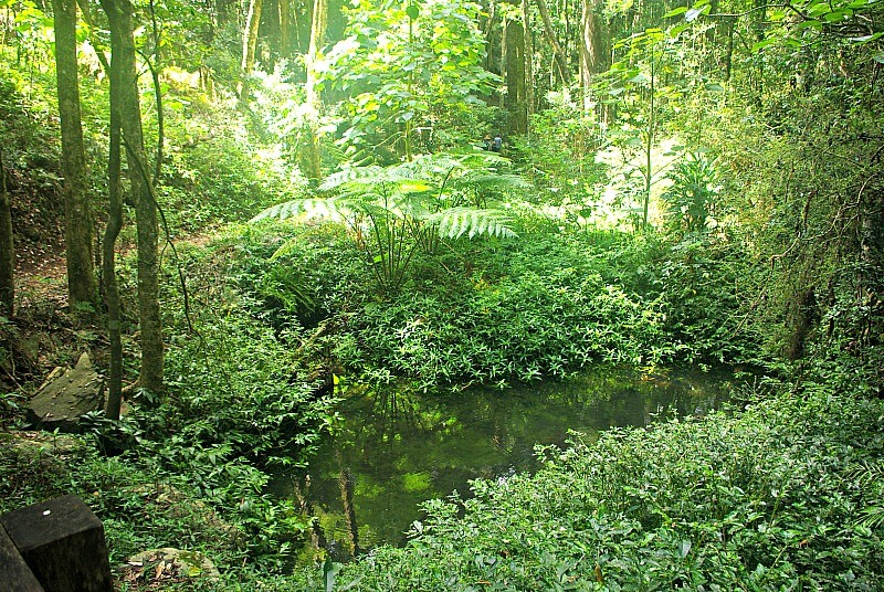
The Scenic Circuit Walk is an easy forest walk, at times creek-side with seasonal water holes. The full walk includes Festoon Falls and Tim Shea falls.
The boardwalk goes through the middle of a Strangler Fig tree, which I must admit is pretty cool.
Anticipating Pine Gorge Lookout would look down into a steep sided gorge, I was surprised by it’s expansive view eastward from the mountain edge.
We really enjoyed this walk and recommend it.
It was super green in this particular spot, but this was the exception.
Bunya Bunya Walk
For a warm-up take this 500 m walk/stroll. It starts at the back of Dandabah Camping Ground and ends at the Dandabah Picnic Ground.
Suitable for little ones and the elderly.
Tree Identification Walk from Paradise Falls
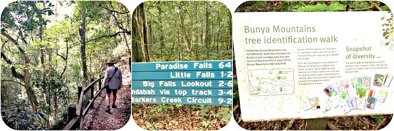
We commenced the walk from Paradise Falls Car Park, but if you’re looking for a longer walk start at Dandabah Picnic Ground.
As we discovered, Paradise Falls were not flowing during our visit. Nevertheless, the walk was enjoyable and we also ventured into the tree identification section. It’s great knowing the names of the trees we admire. Trees are my major interest on any bush walk and most of my time is spent gazing upwards.
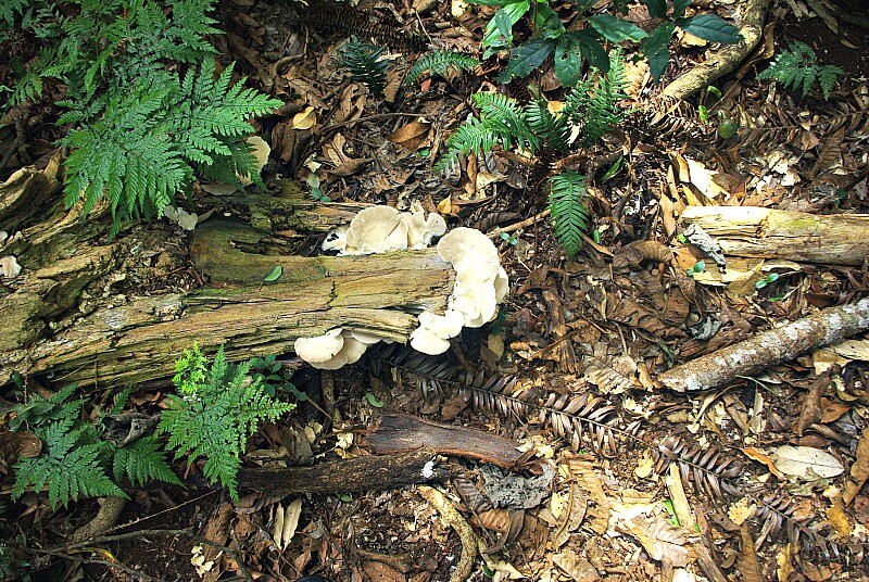
Looking down does have it’s advantages though, like spying this fungi.
Russell Park Walks
Russell Park is located on the Bunya Mountains Road shortly before entering Bunya Mountains National Park.
You will see a sign to Russell Park Picnic Area where some of it’s walking tracks begin. The park is managed by Western Downs Regional Council and Aboriginal Rangers.
One of the walks begins at Fishers Lookout, which is a great place for views and to learn about the area from Information boards.
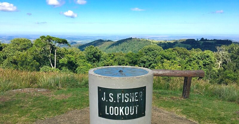
Land for the park was donated by the late Mr. Wilfred Adams Russell. Mr. Russell served on Dalby Town Council (Bunya Mountains is 63 km north-east of Dalby) and represented Dalby in the Queensland Parliament.
Wilfred Russell donated the land contained in Russell Park to the people of Queensland in 1927.
| Fishers Lookout Circuit | 3.4 km return | 2/2.5 hours | Picnic Area Start |
| Cunjevoi Falls | 4.2 km return | 2 hours | Fishers Lookout Start |
| Chute No. 3 | 3.4 km return | 1/1.5 hours | Picnic Area Start |
| Carbines Chute | 2 km return | 45 mins/1 hour | Munro's Camp Start |
Wildlife Viewing
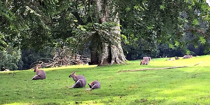
Red-necked wallabies make themselves at home in the campgrounds and the green grassy areas around Dandabah. Swamp wallabies and red necked pademelons are shy and prefer the forests.
We heard Whip Birds calling in the forest.
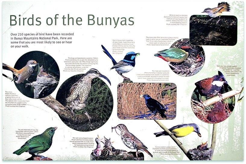
The old School House is a good place to look for bats and bring a torch to spotlight for Ringtail Possums in the trees after dark.
Campgrounds attract Satin Bowerbirds, colourful parrots like King Parrots and Crimson Rosellas but there are literally hundreds of different bird species.
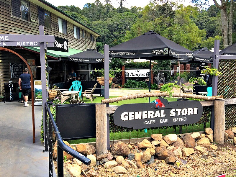
Special feed trays can be purchased at the General Store ($5/person/30 minutes) to feed the parrots.
Buy Wild Bird Feeding Trays at the General Store
Bunya Mountains Markets
When? Last Sunday each month. 9 am to 2 pm. We didn’t get to see them this time around, but will pencil them in for next time.
Bunya Mountains Restaurants and Cafes
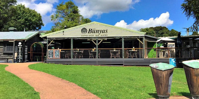
Bunya Mountains Cafe
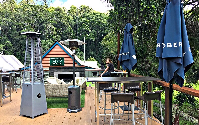
I loved this Coffee Shop/Bar/Restaurant. Mostly open-air, it has a glamorous glass deck fire place which reminded me of Après Ski.
Open for Breakfast Lunch and Dinner, we succumbed to the Bunya Nut scones with jam and cream. It didn’t take much persuading and they were delightful.
Poppies Cafe Bunya Mountains
Poppies on the Hill is opposite Bunya Cafe. As it’s name suggests the cafe sits on a hill overlooking a huge downwards spreading lawn dotted with tall fake poppies and real life wallabies.
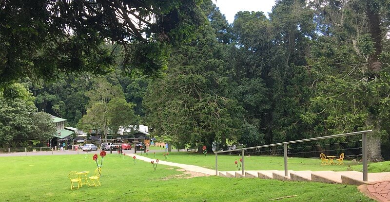
We suggest sitting outside in the Pergola area to catch the wildlife preening and relaxing beneath the pines or sunning themselves. Birds visit the tables also so keep this in mind if you have a phobia.
Our after-walk burger and pie (made on site) were devoured whilst enjoying this view.
Poppies caters for groups of all sizes with a huge indoor restaurant. Call ahead to book for larger groups. Couples are also catered for.
Bunya Mountains Accommodation Centre is part of the complex if you’re looking for accommodation.
Bunya Mountains Caravan Access
I won’t lie. We were undecided as to whether we should take our caravan onto the mountain. The predominant message on very platform I visited was “Don’t Do It”. We are cautious people and having never been before, we ultimately chose not to take our van.
The following is a quote from Parks Queensland Website:
The Department of Transport and Main Roads advises that all access roads are unsuitable for travel by long and/or heavy vehicles. Discretion is urged with respect to caravans, large motorhomes and large buses. No fuel is available on the mountain.
There are three access roads and the general consensus is that the Maidenwell access road is the best when towing.
The Parks Website Map shows Dandabah Campground is suitable for Car Camping, Caravans, Camping Trailers and Motorhomes.
How to Get to Bunya Mountains
Access Via Maidenwell
- Maidenwell is a very small town to the east of Bunya Mountains.
- Route is via Maidenwell/Bunya Mountain Road – 30 km – 3.8 km of which is gravel.
- Time Required 33 minutes.
There are a few kilometres of gravel road on the Maindenwell/Bunya Mountains Road route.
In future (with caution to weather and traffic) we will take our 23 ft. half off-road van up the mountain on the Maidenwell Road. It’s been on far worse roads.
This is our personal opinion for our own van and is not my advice to you.
On our first visit however, we free-camped a couple of nights at Maidenwell, left our van there, and day tripped to Bunya Mountains.
Note: There is signage saying the road is not recommended for caravans. I’m not sure if this would affect insurance policies.
On arrival we found several small caravans and camping trailers at the Dandabah Campground.
Access via Toowoomba
I believe that this route up the mountain is the most challenging for towing but we have not been on it.
- Toowoomba is a large country town to the south of Bunya Mountains
- The sealed Route is via Warrego Highway/A2 – 109 km, via Dalby on Dalby Cooyar Rd and Bunya Mountains Rd, via Kaimkillenbun entering mountain from the south.
- Route with 2 km of gravel is via Warrego Highway, turn right at Jondaryan, to Quinalow and left at Maclagan entering mountain from the south.
- Time required 1 hr. 33 min.
Access via Kingaroy
- Kingaroy is a small country town to the North
- The Route is via Bunya Highway/State Route 49 – 58 km
- Time required 51 minutes
Note: We descended from Bunya Mountain to Maidenwell via this (Kingaroy) route and while still on the mountain it has more ups and downs and is far less suitable for Caravan towing than the Maidenwell Route.
Bunya Mountains Accommodation Options
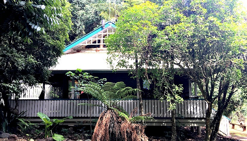
National Parks Office Dandabah
Bunya Mountains Camping Grounds
There are plenty of opportunities for campers in the three National Park campgrounds and we spied some nice looking cabins at the township of Dandabah. At busy times I would recommend booking on-line a month in advance. At normal times a week in advance should be fine. In off-times booking on arrival should be fine. Read more about booking here.
Dandabah
Staying at Dandabah Camping Ground means being perfectly placed for walks on the Eastern Side of the National Park, the most popular being the Scenic Circuit Loop.
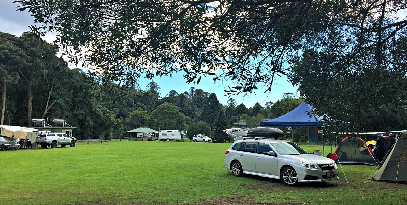
Here you are close to the National Parks Office/Shops/Cafes. The ground itself is grassed, fairly flat and oval – reminiscent of a small show-ground. Everyone seems to camp around the perimeter and kids play in the middle.
Don’t camp here if you want seclusion. All types of camping are allowed and it has the most amenities of all the campgrounds so it is in demand.
Although it has no drinking water (none of the camps do) it does have flush toilets and hot showers – need I say more.
BYO wood for fireplaces.
Westcott
This campground is situated by itself between Dandabah and Burton’s Well.
Tent Camping only with Bollards preventing caravans and camping trailers entering grassed campground.
Not as big as the others, this camp spot has composting and miraculously smell free toilets, but no showers at all or drinking water.
BYO Wood for fireplaces.
Westcott connects via the west walking tracks south to Dandabah and north to Burton’s Well.
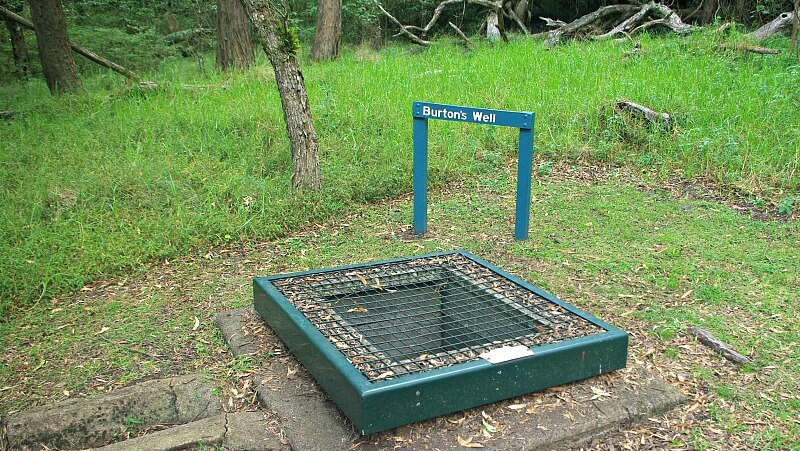
Burton’s Well

Burton’s Well Campground is the closest to the Northern entrance from Kingaroy and some 20 minutes from Dandabah.
The walk to Mt. Kiangarow begins here and links to other west walks leading south to Cherry Plain picnic area, Westcott and eventually Dandabah.
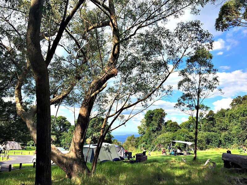
This is a loved grassed campsite. It is quite spread out with lovely views to the east and Burton’s well at the top of the area. There used to be wood supplied but not now.
Burton’s Well was dug during the drought of 1901/2 by Bob and George Burton to water their horse and bullock teams. It was still in use in the 1970’s for road construction and by visitors. The Burton family still lives in the area.
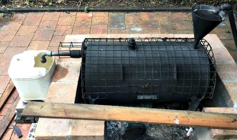
Unfortunately there are only cold showers or water must be heated in an antiquated wood fired contraption called a Donkey. After heating, cold water is mixed until the correct temperature is reached, before pouring into the in-situ shower bag.
Heating water in the Donkey is a task best tackled before happy hour.
BYO Wood for fireplaces.
Tent Camping only with Bollards preventing caravans and camping trailers entering grassed campground.
The historic Burton’s Well is indeed located at this Campground.
Airbnb Bunya Mountains
Dandabah is the only settlement on the Mountain and cabins and houses are scattered around the town area.
A search on Airbnb for Bunya Mountains shows approximately 18 homes, cabins, chalets that look great.
A very good budget option is Udakak Lodge. It has 3 double rooms each with a Queen Bed plus one of them has a single bed as well.
- All Linen is supplied
- Washing Machine and Dryer
- Fireplace (with guards)
- Full Kitchen
- BBQ and Pizza Oven on Verandah
- 5 out of 5 * in all categories
- Directly opposite National Parks Office
- Walk everywhere in the village
- Parking
- Full refund up to 5 days before stay (minus Airbnb service fee)
- CHECK ALL THESE DETAILS BEFORE BOOKING AS THEY CAN CHANGE
Look and Book through the below box:
Bunya Mountains Farmstay
The nearest farmstay to the mountain is Bunyip Springs Farmstay at 503 Maidenwell-Bunya Mountain Road, South Burnett, 5km west of Maidenwell. From there it is a further 23 km to Bunya Mountains. We haven’t stayed but it has marvellous reviews.
Where to stay at Maidenwell – Gateway to Bunya Mountains
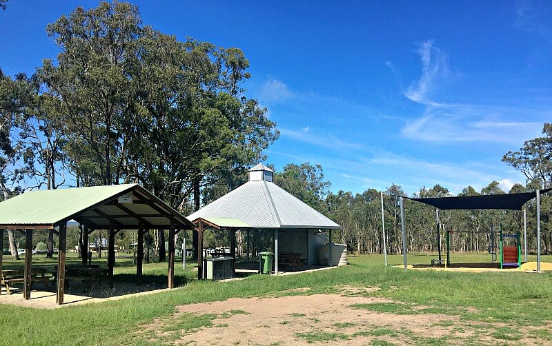
We chose to stay at JA Gorton Oval, one of the free camps situated at Maidenwell, gateway to Bunya Mountains Queensland.
This beautiful big area is surrounded by bushland on one side and is large enough for big rigs. It has BBQ area, playground and a modern pre-fab. shower and toilet block.
Situated next to Maidenwell Pub which has it’s own free camp.
Be sure to contact me if you have any questions you would like answered and enjoy the Bunya Mountains!
More from my site
 Tuesday in Townsville – Outriggers and Stingers on The Strand
 Free Walking Tour Ljubljana – Churches in cool Locations
 Europe Bucket List – Budget Saving Tips from Travel Bloggers
 Quirky Sun Salutation Zadar Eerie Zadar Sea Organ and Things to Do in Zadar
 Ten Reasons Plus One to Visit Istanbul
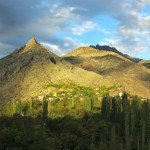 When to visit the Black Sea Coast and Eastern Turkey plus a Road Trip Surprise
 Fun Things to do in Townsville Australia and Magnetic Island